Answer the client question that the listing cannot.
Land tenure, mapped cesspool evidence, FEMA flood zone, sea-level-rise exposure, short-term-rental registration, zoning and permit history for any Oʻahu address — each with the county record it came from and the date that record was published.

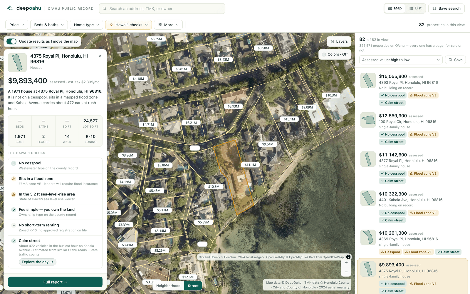
The eight questions, in about sixty seconds.
Each one is a field a public authority published, shown with its source and its date. Nothing here is a score, and nothing here is our opinion.
Is it fee simple, or leasehold?
The county's ownership-type record, decoded. Land-tenure evidence — not a title opinion, and it says nothing about the ground-lease term or buyout.
Is it in a FEMA flood zone?
The official zone, and whether the parcel is in a Special Flood Hazard Area. A regulatory designation, not a risk score and not an insurance determination.
Is it in the sea-level-rise exposure area?
Against the State's 3.2 ft sea-level-rise inundation modelling.
Is there a cesspool on it?
Mapped cesspool evidence and the Department of Health replacement-priority band, from 10,805 mapped systems on Oʻahu.
Is there a registered short-term rental?
The county's short-term-rental registry — who currently holds a certificate. It is a registration record, not a ruling on whether a property could ever be rented short-term.
What is it zoned, and how big is the lot?
Zoning class with its description from the State's county-zoning layer, plus lot size and legal description.
What has been built here, and when?
Permit history on the parcel from 432,021 county permit records, 2005–2025, alongside the building record: year built, floors, dwelling count, floor area.
What is it assessed at, and who owns it?
The county assessment split into land and building with exemptions and tax year, the owner of record, and the tax-bill mailing address — the owner-occupant versus absentee signal.
Three steps, and the third is the one that gets used daily.
The shareable link is the part that changes how the day goes: your client sees the parcel you saw, with the layer you had on.
- Search the address.Address, TMK, owner name or legal description, across ≈326,000 Oʻahu properties and ≈172,000 mapped parcels. No account, no trial, nothing to install.
- Read the record.The Hawaiʻi fine print sits at the top of the property page, each line naming the record it came from and the date that record was published. A condo unit gets its own page, with its own assessment and owner, on the parcel it actually sits on.
- Send the link.The camera, the colouring, the filters and the selected parcel are all in the URL. Paste it into the email and your client opens exactly what you were looking at — no login, no export, no attachment.
What Pro adds.
The working layer on top of the free record: the saved work, the exports, and the measurements of the property itself.
Saved properties and saved searches
Keep a list of the addresses you are working and the filter set that found them.
Watchlists and alerts
Be told when a record changes on a property you are watching.
Property comparison
Put properties side by side on the fields that decide it.
Professional exports and PDF dossiers
A filtered list as CSV, and one property as a source-cited document you can hand to a client.
Full aerial investigation
The 2024 county capture at 7.94 cm per pixel at the deepest level, with the parcel boundary over it.
Permit and property timeline
The parcel’s history in order — permits, assessments and recorded transfers.
View and site intelligence
What can be seen from the property, what blocks it, and how steep the lot and the driveway are.
Advanced filters and multi-year tax history
Base flood elevation, parking stalls, gross floor area, quiet-street tier and road attributes, plus the full county assessment dossier.
Everything above the Pro list is free. The whole Oʻahu map, every property page, every map colouring and all five Hawaiʻi checks cost$0 — no account, no trial period, no card. Pro is$99 a month, locked for twelve months.
Start with the next address on your calendar.
Look up a property you already know. If the record does not tell you more than the listing did, we have not done our job.